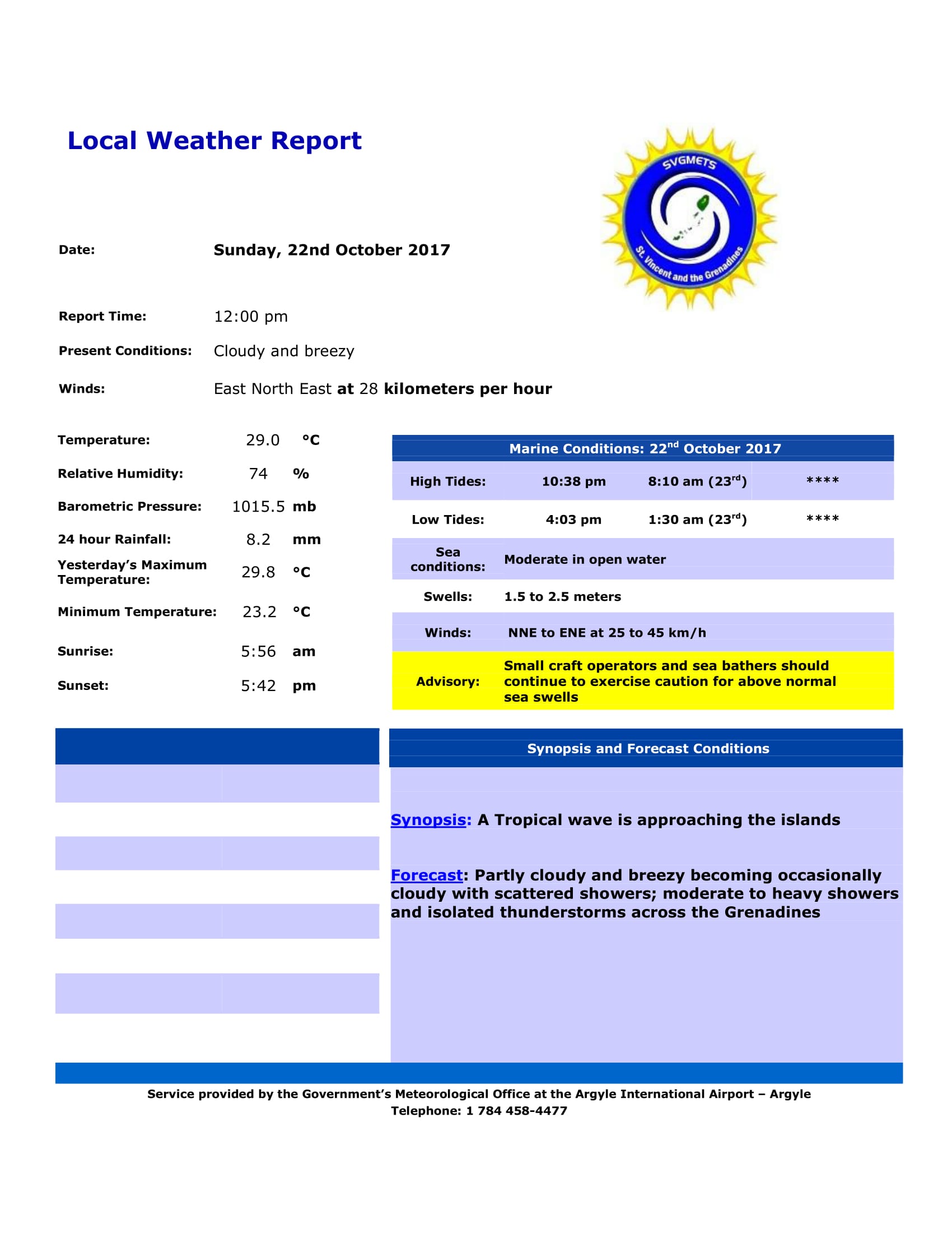
The shear-line at low levels continues to affect our islands today. Heavier showers and thunderstorm activity can be expected across the Grenadine islands. The approach of a tropical wave tonight will result in continued cloudiness, occasional showers, periods of rain and isolated thunderstorm. Moisture levels and instability remaining elevated until Wednesday due to upper level support and enhancement.
Over the Caribbean Sea, a low at the upper levels could induce a lower level low by early Monday, which should be steered eastward toward the island chain. The positioning of the upper and lower associated troughs could create the potential for sustained showers and thunderstorm activity across the island chain Tuesday. Although models show most of the activity just north of SVG by Tuesday afternoon, residents should be on the alert…. Rainfall accumulations could trigger overflowing of rivers and streams causing flooding. These features will be closely monitored.
Fresh (29-38km/h) east-northeasterly breeze should continue this afternoon, becoming moderate (20-28km/h) by Monday. Moderate (1.5m - 2.5m) seas should become slight to moderate by Tuesday, with patchy slight haze breaking temporarily on Tuesday.

