
What Are Tsunamis?
Tsunamis (pronounced soo-na-mees) are often incorrectly referred to as tidal waves, but a tsunami is actually a series of waves that can travel at speeds averaging 450 - 600 miles per hour in the open ocean. As the waves approach the coast, their speed decreases and their amplitude increases. Unusual wave heights have been known to be over 100 feet high. However, waves that are only a couple of feet high can still be incredibly destructive, causing widespread devastation.
From an initial tsunami generating source area, waves travel outward in all directions, much like the ripples caused by throwing a rock into a pond. As these waves approach coastal areas, the time between successive wave crests varies from 5 to 90 minutes. The first wave is usually not the largest in the series of waves, nor is it the most significant. Furthermore, one coastal community may experience no damaging waves while another, not that far away, may experience destructive deadly waves. Depending on a number of factors, some low-lying areas could experience severe inland inundation of water and debris of more than 1,000 feet.
Following the 2004 tsunami in South East Asia, and the more recent one in Japan in 2011, much greater attention is been given to the risk they pose to Saint Vincent and the Grenadines. With 85% of the population living on a narrow strip below 5 metres and less than 5 km from the high water, 80% infrastructure and 90% of economic investment also on this narrow strip, a single tsunami could be devastating.
Earthquake-induced movements of the ocean floor most often generate tsunamis. Landslides, volcanic eruptions and even meteorites can also generate a tsunami. If a major earthquake is felt, a tsunami could reach the beach in a few minutes, even before a warning is issued. Areas at greatest risk are less than 25 feet above sea level and within one mile of the shoreline. Most deaths caused by a tsunami are because of drowning. Associated risks include flooding, contamination of drinking water, fires from ruptured tanks or gas lines, and loss of vital community infrastructure (police, fire and medical facilities).

The 2004 Indian Ocean tsunami could rank as the most devastating on record. More than 200,000 people lost their lives, many of them washed out to sea. The most damaging tsunami on record before 2004 was the one that killed an estimated 40,000 people in 1782 following an earthquake in the South China Sea.
Tsunamis in the Caribbean
In the past 500 years there have been ten confirmed earthquake-generated tsunamis in the Caribbean Basin, with four causing fatalities. An estimated 350 people in the Caribbean were killed by these events.
All known sources capable of causing tsunamis occur within striking distance of the Eastern Caribbean, and there are also distant sources across the Atlantic. Since the islands lie in an area of relatively high earthquake activity for the Caribbean, the most likely tsunamis to affect the region are those which can be triggered by shallow earthquakes (<50km depth), in the region, greater than magnitude 6.5. The recurrence rate for tsunamis in the Caribbean is approximately one destructive tsunami per century for local earthquakes and one destructive tsunami per 200 years for distant earthquakes.
Currently, there is no tsunami warning system for the Caribbean, however, an interim arrangement exists with the Pacific Tsunami Warning Centre. Scientists at the Seismic Research Unit at the University of the West Indies St. Augustine campus in Trinidad and Tobago, together with other regional agencies such as the Caribbean Disaster Emergency Management Agency (CDEMA), are in the process of developing a warning system but it may be several years before this is complete.
Contributing sources Jamaican
Office of Disaster Preparedness and Emergency Management
CDEMA
- Animation of how a tsunami occurs
http://news.bbc.co.uk/2/hi/science/nature/7533972.stm
- Find out if your home is in a danger area by knowing the distance it is from the coast.
- If you live in a low-lying area for instance near to the beach learn the quickest way to get to high ground. A safe area would be at least 30m (~100 feet) above sea level and 3 km (~ 2 miles) inland. Teach and practice the evacuation plan with all family members.

- Discuss tsunamis with your family and friends. Everyone should know what to do in case all members are not together.
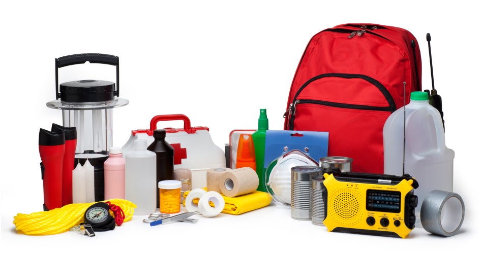
- Emergency items such as canned foods, medication, flashlights, battery-operated radios, bottled water and First Aid kits should be readily available and working properly.

- FEEL

Strong local earthquakes may cause tsunamis.
FEEL the ground shaking severely?
DROP COVER HOLD and then RUN to higher ground
- SEE

As a tsunami approaches shorelines, the ocean may pull back from the coastline significantly, exposing the ocean floor, reefs and fish.
SEE an unusual disappearance of water?
RUN to higher ground
- HEAR

A roar like an oncoming train or plane may be heard as a tsunami rushes toward the shore.
HEAR the roar?
RUN to higher ground
- RUN

Don't wait for official evacuation orders.
Immediately leave low-lying coastal areas e.g. beaches.
Do not try to surf the tsunami.
Move inland to higher ground.
RUN if you see a tsunami coming!
Never go down to the beach to watch for a tsunami.
During a tsunami :
- If you detect signs of a tsunami evacuate and move to higher ground at once.
- If possible, stay tuned to a radio, or television or log on to the SRC website at www.uwiseismic.com to get the latest emergency information.
- Never go down to the beach to watch for a tsunami. If you can see the wave, you are already too close to outrun it. /
- A tsunami is not a single wave, but a series of waves that can come ashore for hours. The first wave may not be the largest. Stay out of danger areas until an all-clear is issued by a recognized authority e.g. your local disaster management office.
- If you detect signs of a tsunami move immediately to higher ground!
- If possible, stay tuned to a radio, or television or log on to the SRC website to get the latest emergency information.
- Help injured or trapped persons.
- Keep out of stagnant water.
- Open windows and doors to help dry buildings.
- Shovel mud while it is still moist to give walls and floors an opportunity to dry.
- Stay out of damaged buildings. Return home only when authorities say it is safe.
- Check food supply and test drinking water.
- Fresh food that has come in contact with flood water may be contaminated and should be thrown out.
- Check for damage to sewer and water lines.
Contributing sources:
UNESCO IOC International Tsunami Information Center
University of West Indies Seismic Research Centre
CDEMA
USAID
Further information: