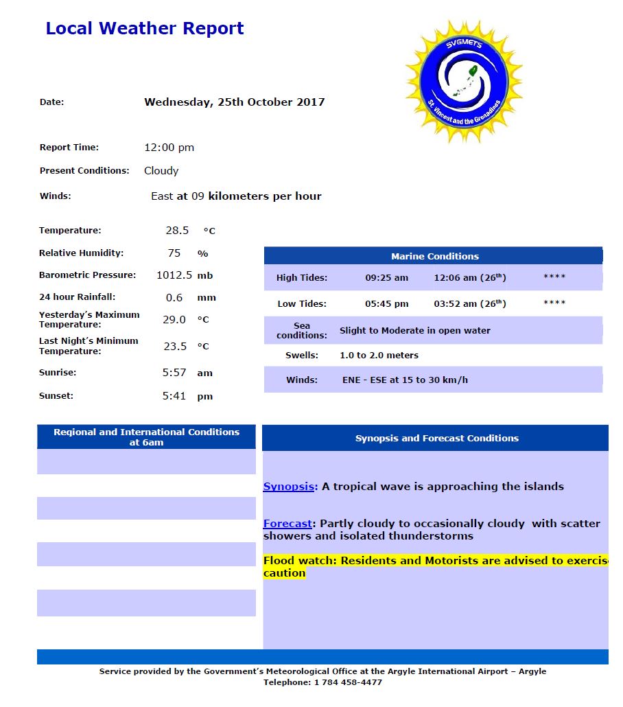
SYNOPSIS: A tropical wave is approaching the islands
FORECAST: Partly Cloudy to occasionally cloudy with scattered showers and isolated thunderstorms
WINDS: ENE-ESE at 15-30km/h
Slight to moderate in open water with swells 1..0-2.0m
The trough systems are creating most of the shower activity just north and east of our area due to the positioning of the mid to upper level trough over the island chain. Increased cloudiness should return to our islands and the chance of showers should increase again this evening with the approach of a tropical wave. Meanwhile, an upper level low over the Caribbean Sea (west of the island chain) will again give support and enhancement to the approaching tropical wave Thursday. By Thursday afternoon, gentle winds combining with any possible daytime heating could contribute to localized showers and thunderstorm activity across our islands.
Within the low levels, a low is possible to develop along the ITCZ on Thursday evening, but is expected to reverse back to an open wave by Friday. This area of possible disturbance could reach our area by early next week (…more analysis).
Moderate to gentle (28 -15 km/h) breeze this afternoon from east to east south easterly direction should turn east-northeasterly by tonight. Moderate east-southeasterly flow is expected on Thursday, becoming gentle by afternoon. Slight seas on the west and slight to moderate (1.0m - 2.0m) seas could become occasionally slight on the west coasts. Patches of slight haze are expected to alternate with shower activity throughout the rest of the week.
Regards
Mc Donald
Meteorological Services.
Argyle International Airport,
St. Vincent & the Grenadines
Phone/Fax: (784) 458-4477